
Each week during the wildfire season, Dr. Mike Flannigan will share a five- to 10-day fire weather outlook for Canada. This is a first step in developing a national early warning system for wildfire in Canada. The fire weather outlook will be posted every Tuesday.
Mike Flannigan is the scientific director of the Institute for Wildfire Science, Adaptation, and Resiliency as well as the BC Innovation Research Chair in Predictive Services, Emergency Management and Fire Science at Thompson Rivers University.
View bioWeekly Outlook | July 18-23, 2026 Issued July 14, 2026
All information provided below is reported at the time of publication and may not reflect more recent updates.
Current fire situationPrime time fire season
After a quiet start, the fire season is now in full swing. On the national scale, July is typically the most active month in terms of area burned. Currently, we have burned 1.8 million ha and have 801 active fires with 688 classified as out of control fires (Figure 1). Out of control fires can be actioned or monitored – most of the out of control fires are being monitored (513 fires – see the purple row).
As the fire season picks up, we see a lot of smoke. Last Tuesday (July 7), there was an awful smoke episode in Kamloops, B.C. from the Brunswick Creek complex in the Fraser Valley (Figure 2). On Monday, July 13, hot, (temperatures exceeded 40 C in places), dry and windy conditions over parts of northwestern Ontario led to numerous active fires including at least one pyrocumulonimbus (Figure 3).
The Canadian drought map was just updated, and you can see drought areas over much of B.C., parts of the N.W.T, northeastern Quebec and most of Labrador (Figure 4). These areas have set the stage for active fires, but drought does not guarantee fires as you still require ignitions. Likewise, if a region is not in drought that does not preclude active fires as surface fuels can dry very quickly and give rise to a raging inferno. For example, Figure 3 shows very active fires in northwestern Ontario, where most of the fires are not in a drought region. Additionally, there are many fires south of Great Bear Lake and most of those fires are not in drought.
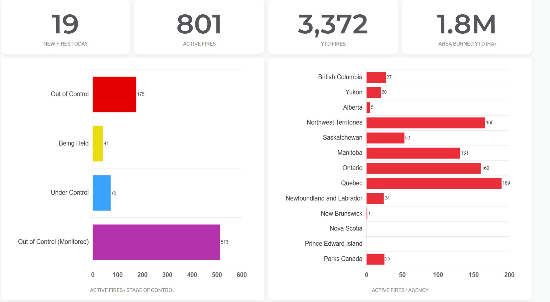 Figure 1. Number and status of fires in Canada as of July 14, 2026. CIFFC | Home
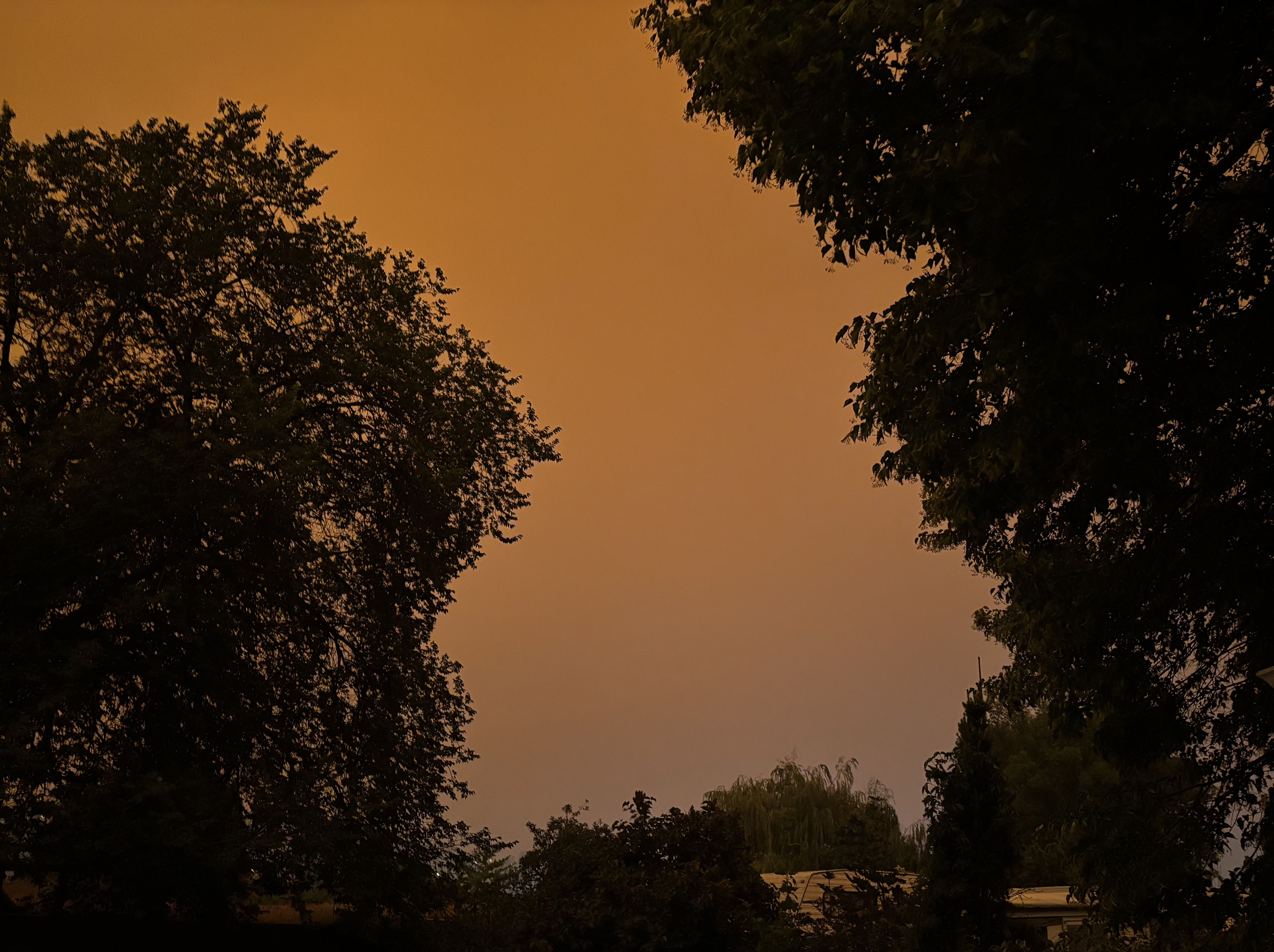 Figure 2. Photograph of the Kamloops sky at 6:45 p.m. PT on July 7, 2026.
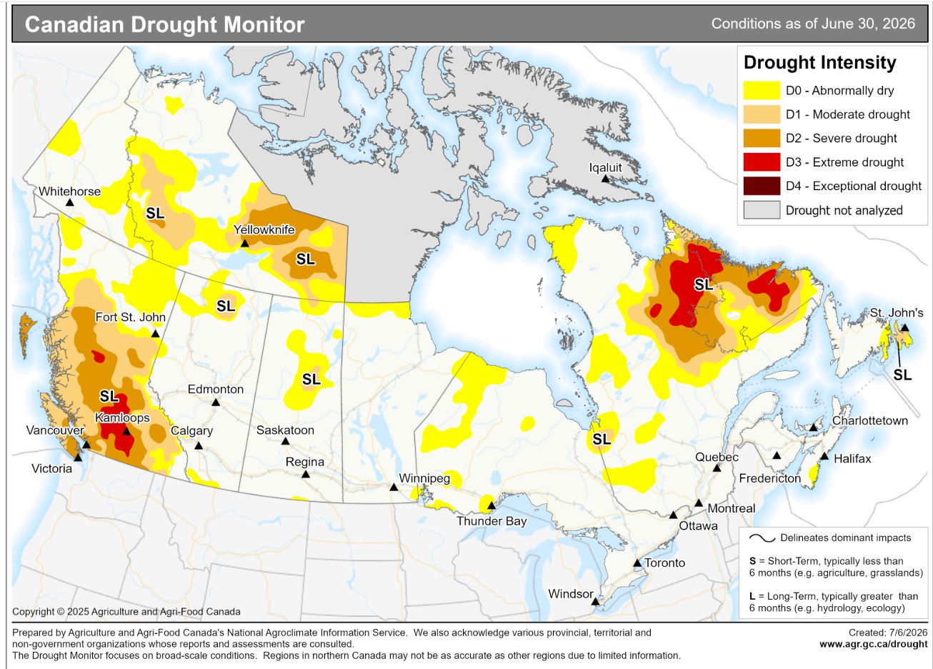 Figure 4. Canadian drought conditions as of June 30, 2026.
Current drought conditions - agriculture.canada.ca
Fire weather outlook July 18- July 23
A broad upper ridge develops over western Canada bringing hot weather and conducive fire weather to much of western Canada (Figure 5). Of concern is the potential for significant lightning activity over B.C., northern Alberta and the N.W.T. (Figure 6), which could lead to numerous fire starts especially in B.C. There is also the potential for significant fire activity during the outlook period in B.C., N.W.T., northern Alta., northern Sask., northern Man. northern parts of Ont. and around James Bay in Que. Might see fires pick up in southern Yukon particularly towards the end of the outlook period.
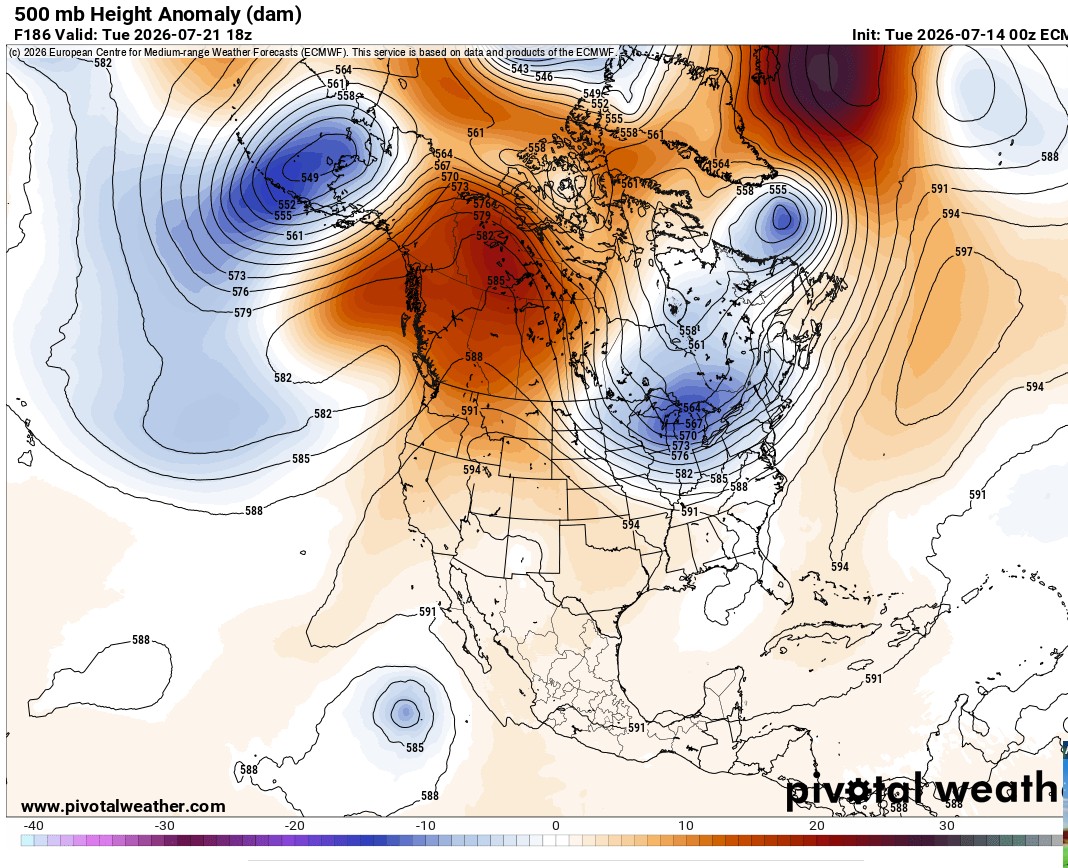 Figure 5 ECMWF 500 mb heights and anomalies, July 21, 2026.
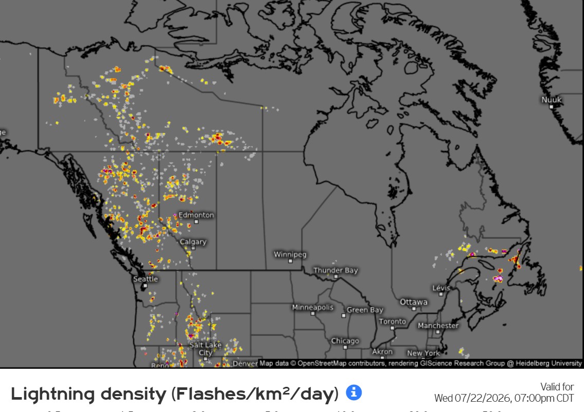 Figure 6. 12-hour lightning density forecast for July 22, 2026.
A look ahead – August 2026 and El Nino
The ensemble forecasts for August are out, and it looks like a warm to hot August over Canada with near normal precipitation (Figures 7 and 8). Southern B.C., however, looks drier and hot for August.
It seems likely we will have a strong El Nino by the fall or early winter. This will not have much impact on the current Canadian fire season though it might contribute to extending the fire season well into the fall especially for B.C. and Alta. A warm and dry winter is likely for western Canada in 2026/2027, which could set the stage for an early and quick start to the 2027 fire season. If you want to keep up to speed on the ENSO/El Nino situation, check out PowerPoint Presentation.
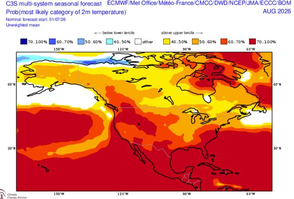 Figure 7. C3S temperature forecast for August 2026.
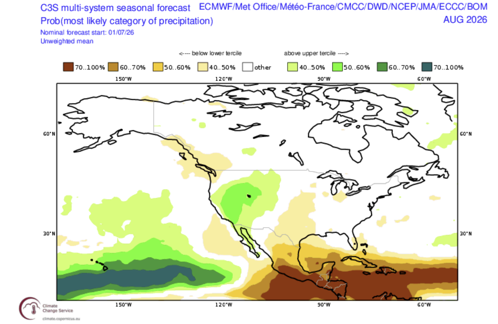 Figure 8. C3S precipitation forecast for August 2026
Weekly forecast history
Questions?We have the answers
Questions, including media requests for Mike Flannigan, can be emailed to wildfire@tru.ca.
Want to keep up with fire weather and fire activity? Check out @mikeflannigan.bsky.social.
Subscribe to the Canada fire weather outlook